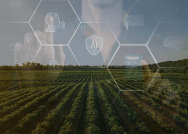
How To Use Satellite Data in Agriculture
According to NASA, satellite imagery has been used in agriculture since 1972 as part of their Landsat program.
Since then, it has evolved into a million-dollar industry, valued at $516.1 million in 2022 and expected to reach $785.3 million by 2028.
If you want to understand more about the booming industry of satellite farming, read on.
We’ll explain how it works, discuss the main benefits of implementing satellite farming technology, and show you real-life examples from industry leaders. Stay tuned!

Satellite farming is collecting and using satellite data about the weather, the soil, and a lot of other environmental factors important for agriculture. This data can be used to create maps, navigate autonomous vehicles, and optimize resources.
One of the greatest benefits of satellite-based technology is that most of the data is freely available. NASA and some other organizations provide access to their satellite imagery to the public. This is also one reason why the industry is thriving, and new innovations can remain cost-effective.
However, in order to make use of this data, we need to combine it with different technologies.
These are responsible for transforming the data into insights by managing and visualizing it. Agriculture satellite data falls under the ‘big data’ category. And to use big data in agriculture, first, you need to collect a large amount of data, then analyze it, and finally plan and implement solutions based on the results.
Here’s a list of the most commonly used technologies in the agricultural industry:
- AI and modeling tools — to analyze the data and combine it with other information (like historical data) to model and forecast the changes.
- Cloud and data management solutions — to store and organize the huge volume of data.
- Data visualization and dashboarding tools — to turn the numbers and tables into clear maps and diagrams.
- Sensors and IoT — in-field smart tools to collect data and perform actions based on it.
- Precision agriculture platforms — to have all the information in one place.
Now, let’s look at the specific use cases. To show you the different ways of utilizing satellite technology in farming, we collected real products from market-leading companies.
The most obvious use case of satellite data in agriculture is mapping and monitoring fields. However, much has changed since this technology was first used in the 1970s. And the modern challenges in agriculture require modern solutions, as you can see in the next example.
Drone and satellite mapping in precision agriculture
A hybrid solution from PIX4D combines drone imagery with satellite data. Their tools allow farmers to map their crops in minutes to analyze crop health and more.
They can define application zones so they can use fertilizers precisely where they’re needed or even use AI to identify weeds and apply herbicide only on the exact spot. This is not only environmentally friendly and regulation-compliant but also helps users maximize profits.
One of the most pressing issues farmers face due to climate change is water usage. Let us show you two examples of how using satellite data in agriculture can reduce water waste and help farmers and communities worldwide.
In-field sensors & satellite data for farmers to optimize watering
When the founder of Tule Technologies realized that most farmers don’t know how much water their crops actually need, the company developed the next-level solution.
Their technology calculates the actual evapotranspiration (ET). In other words, how much water evaporates from the plant and the soil, so farmers will know when, and how much watering their crops need.
It combines in-field sensors and satellite data provided by NASA.
Their tools were implemented in vineyards, pistachio and almond orchards across California with great results. And since irrigation accounts for around 80% of fresh water use in the US, this innovation is a huge step in the right direction.

Tule Technologies evapotranspiration sensor. Image credit: Tule Technologies
AI & satellite data analysis to reduce water usage by 30%
While water waste is a problem everywhere, it is especially devastating in developing countries. To battle such environmental challenges, Microsoft and National Geographic have given away the AI for Earth Innovation Grants to hundreds of organizations since 2017.
One of them was the Danish DHI GRAS, which has developed a solution combining AI technology with satellite data to help farmers optimize water consumption.
It’s currently being tested in Uganda, where farmers otherwise have limited access to agritech knowledge and data.
The goal is to accurately measure how much water crops emit in evaporation and calculate how much water is needed.
They use satellite technology to gather data on evapotranspiration (ET) and then feed the data to an open-source AI algorithm that combines optical, thermal, and meteorological data.
DHI expects 30% less water use for the same crop yield, which can contribute to food security and economic growth for the local community and the country as a whole.
And what’s even better: other countries can also adopt this solution in the future at a minimal cost. The AI algorithm is freely available, solving one of the biggest cost and tech challenges of big data.
Gain a bird’s eye view of your agribusiness!
Maximize your yield and minimize waste with custom-built satellite and AgTech solutions.
DISCOVER OUR SERVICESThe cost of weather and climate disasters is rising. In 2024 alone, the US registered $14 billion lost, and we’re far from the end of the year. Severe weather conditions, such as droughts, floods, or volatile temperatures, can be catastrophic for every industry, especially agriculture.
To defend against weather disasters, agribusinesses and farmers use the Joint Polar Satellite System (JPSS) to predict such events. This group of satellites monitors weather conditions and crop health non-stop. It provides farmers with accurate forecasts and prepares them for events such as hurricanes or blizzards.
In general, satellite data is freely available to use. However, some agritech businesses invented next-level tools to utilize weather-related satellite data.
Advanced soil moisture analysis with satellites
EOS Data Analytics developed a cutting-edge solution to monitor soil moisture remotely. They combine the data of several satellites with specific algorithms to create soil moisture maps.
This tool empowers decision-makers to improve their planting strategy and drought & flood monitoring. The collected historical data can then be used to model climate change patterns in the future, making this crop monitoring invention the ideal long-term solution.

Satellite weather forecast in agriculture
Autonomous vehicles, such as tractors, are highly sought-after in the agricultural sector. They allow farmers to optimize and automatize their processes, saving time and human resources. Let’s see an example.
Farming satellite auto-steer system
The new CHCNAV system consists of a satellite-powered controller, intuitive software, and an electric steering wheel.
It can navigate vehicles with a 2.5 cm (1 in) accuracy in every weather condition, on uneven terrains. This makes it a fast and reliable equipment and one of the best applications of satellite data for agriculture.

CHCNAV automated steering system used in a tractor. Image credit: CHCNAV
Although the above-mentioned solutions are all aiming towards a sustainable future to a certain level, let us show you some solutions that were created specifically with the environment in mind.
Sustainable precision farming with satellite data
Origin Digital, our long-term client, is famous for its cutting-edge precision agriculture technology. Their tool helps farmers optimize efficiency in their farming processes and boost yields.
It combines satellite imagery with weather and soil data to create hyper-accurate maps. These help users reduce the waste of resources like water and determine the right amount of nutrients the crops need.
Digiteum is Origin Digital’s long-standing tech partner. Our agriculture software developers support the creation of their products as an extension of their team. We work together to build the next generation of advanced farm equipment to ensure a greener future.

Whether you are new to satellite technology or want to scale up your existing systems, we’re here to help.
As a big data development company, we can combine satellite-based data with other technologies, such as IoT, AI, and custom platforms, to create a comprehensive AgTech solution based on your specific business needs.
Our services include:
- Full-cycle software development with a dedicated team
- Team augmentation so you can add a missing specialist to your company
- Consultation so that you can get clarity on your best options
Contact us today to find out more!
Grow your business with satellite data
Stand out in your market with cutting-edge software tailored to your dreams.
HIRE EXPERTSConclusion
As you can see, satellite data in agriculture can take on many forms. It can be used to monitor the weather, map fields and plan strategy, or even to manage water and other resources.
If you’re still unsure whether it is the right solution for you, don’t hesitate to contact us, and together we can discover your best course of action.
FAQ