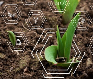
GPS Data in Agriculture: Benefits and Use Cases
The global positioning system (GPS) technology is all around us: in cars, in personal mobile phones, and even in warning systems for natural disasters. No wonder the use of GPS in agriculture, specifically in precision agriculture, is also on the rise.
A Markets and Markets report expects the global precision farming market to grow from USD 9.7 billion in 2023 to USD 21.9 billion by 2031. And the US Department of Agriculture reported that 40% of all U.S. farms and ranches used GPS systems already in 2019.
Both of these statistics prove the growth potential of this industry, which you should not underestimate.
If you are in the agriculture industry, chances are that your competitors are already using GPS in some form. But don’t worry, we’ve collected everything you need to know about this technology so that you can catch up with them as soon as possible.
Read on if you want to learn more about this trend: what are the benefits of GPS in agriculture, what ROI can you expect, and how are other companies using GPS right now as you read?
GPS farming is a big investment. So the most important question on everyone’s mind is, how much profit can GPS agriculture systems bring?
It’s really hard to tell the exact ROI of adopting GPS technology in agriculture. Some early estimates put the total cost savings between 20-30% and calculated that the technology would pay for itself within 2 years. Other sources emphasized that the bigger the farm, the more it’s worth to implement it.
To quickly sum up how GPS is used in agriculture, let’s discuss the three main stages.

- Data collection. GPS can be built into tractors, harvesters, sprayers, or even drones and robots. With the help of the satellite system, these can all collect farm data about crops and livestock. GPS is one of the main technologies connected to using big data in agriculture.
- Data analysis and planning. The data is managed by the most advanced software solutions and technologies, such as AI and machine learning. After interpreting the numbers, systems are able to use them in many different ways. Including the creation of 2D and 3D maps, pinpointing locations, and comparing conditions and historical data.
- Application. The last step is to implement the solutions based on these plans. The goal is to optimize crop cultivation and the usage of resources and farm equipment to maximize profits.

1. High accuracy
When used in precision farming, GPS can provide data as precise as 1-centimeter accuracy. This is a huge advantage for field mapping.
You can map out the best spots for testing the soil for nutrients so that you can plant with the greatest yield. Or even divide the farm into sections for easier management, water, and fertilizer distribution.
2. Sustainable growth
One of the main goals of the modernization of agriculture is to find environmentally friendly solutions while increasing the yield. The use of GPS in precision agriculture has a lot of environmental benefits.
Because of its accuracy, it can help prevent the excessive use of chemicals, such as pesticides, and the wasting of water and other resources. This is good not only for reaching sustainability goals and adhering to regulations but also for maximizing profits.
3. Works in all conditions
GPS always functions, even in bad weather or light conditions. This allows farmers to operate machinery, such as tractors, safely on the fields during dark hours, in rain, fog, or dust. They can stay on schedule and complete field operations on time.
4. Efficient automation
A key aspect of modernized agriculture is to optimize processes using technology and replace inefficient components. An important GPS application in agriculture is to power autonomous vehicles, robots, and other machines.
This allows farms to accelerate processes and save human resources. A few employees are enough to monitor and control them from afar.
Head in the right direction!
Increase your ROI with custom-built GPS and AgTech solutions.
DISCOVER OUR SERVICESIn this section, we’ve collected a few real-life examples of GPS and GIS technologies (GIS stands for Geographic Information System). These inspiring tools and products will help you understand the benefits and different uses of GPS for farming. Let’s dive in!
GPS-based monitoring system by OriginDigital
Our long-term client, OriginDigital, offers a suite of cutting-edge tools that enable farmers and agribusinesses to monitor and optimize farm performance. They combine advanced weather models, satellite imagery, topography analytics, and other data to create all-encompassing maps for decision-makers.
Origin Digital uses GPS data on an award-winning mobile application for field observation. It enables users to monitor field conditions, pinpoint locations, and share their insights with team members.
Our engineers contribute to the development of OriginDigital’s products. As an AgriTech app development company, we scale up their tech team and help them build, scale, and support their data-driven solutions for precision farming.

GPS tractor systems by FieldBee
A major player in the precision agriculture market, FieldBee has created several products based on a farming GPS system. The manufacturers’ main goal is to power tractors on the fields, eliminating overlaps and missed spots with a 2.5 cm accuracy. According to their website, the tools can save 10-15% of the input and labor costs for farmers.
Their agriculture GPS technology combines IoT (Internet of Things) and modular architecture. It can be used on smartphones and tablets. Customers can choose between the manual steering and the autosteering options.
GPS-powered drone sensor by Sentera
Sentera’s sensors can be connected to crop-monitoring drones to collect data. The system is powered by GPS and GNSS (Global Navigation Satellite System) technology to ensure high accuracy. The goal is to create accurate maps about crop health, pests, and weeds.
If you are awed by the above examples of farm innovations, it’s time for you to take the first step toward bringing your ideas to life.
All you have to do is contact our expert team, and we’ll lead you through the process from the first call to the development and ongoing support. We can provide you with:
- Agriculture software development services: Expand your business with custom-built software, including agriculture portals and applications.
- Big data management services: Set up a complex system to collect and analyze data at large to optimize your processes and increase profits.
- IoT development services: Make sense of IoT data from smart devices and monitoring tools in your agribusiness to achieve sustainability goals and cut costs.
- … and more!
You can access all our services through diverse cooperation models. You can choose full-cycle development if you don’t have your own tech team. But you can also add a missing specialist to your existing project who can fill the knowledge gap. Let’s connect and discuss your project and ideas!
Empower your business with GPS-based insights
Future-proof your company with cutting-edge software tailored to your specific needs.
HIRE EXPERTSConclusion
When comparing the advantages and disadvantages of GPS in agriculture, you will find that the benefits outweigh any possible challenges. One such challenge is the high acquisition costs, but the numbers show that, in most cases, the investment returns within a few years.
However, you should always prepare a thorough analysis of whether it is the best solution for your business. Always consult with experts, and choose the best AgTech companies to cooperate with.
FAQ